![[Translate to English:]](/fileadmin/Der_SAC/Unserer_Partner/CSS_cyan_rgb.svg)

Approach Segnesboden Segnesboden 2100 m
-
- Difficulty
- T2
-
- Ascent
- 1:15–1:45 h, 293 m
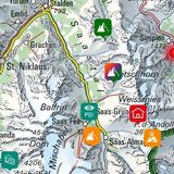
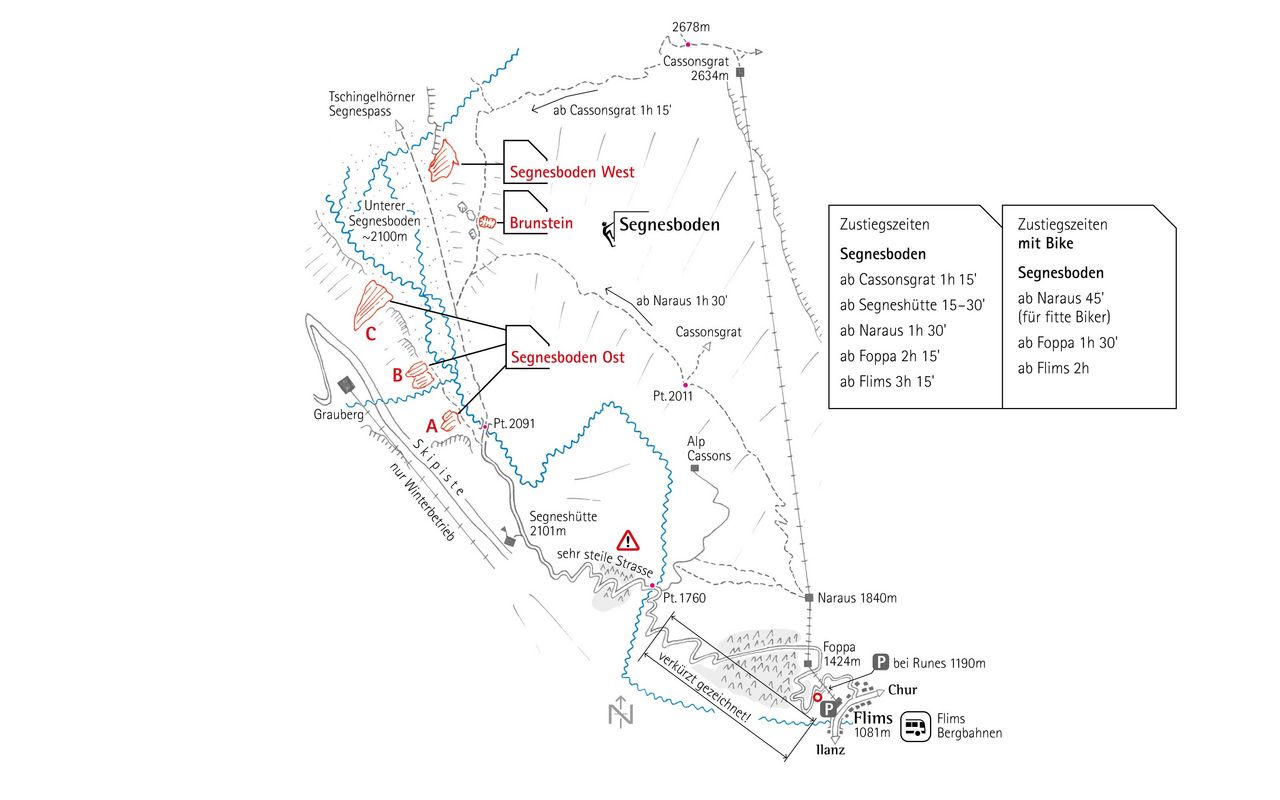
The shortest approach to the climbing area Segnesboden is currently from Alp Naraus. ((No cable car to the Cassonsgrat at the moment!))
Nice footpath panorama.

Route description
Approach to Segnesboden from the cable car Naraus
From the mountain station at Naraus (1840 m), a nice panorama trail leads, at first slightly uphill, then contouring along to the entrance of the broad valley of the Segnesboden. To cross the stream it is worth heading towards the Segneshütte and using the bridge there (otherwise you'll be wading). The different sectors are easily found by walking along the cliff base away from the hut.
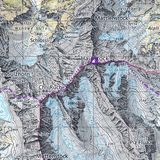
Appraoch to Segnesboden from Flims
From Flims, follow the marked mountain trail to the Segneshütte. By car you can get as far as Runcs, ca. 1190 m. With a bike follow the road via Foppa and Startgels to the Segneshütte; on foot it is possible to take various shortcuts. From the hut it is an simple walk to the cliff base where the individual sectors are easily found.
About 3:25 hours from Flims, 1030 meters in altitude, T1 / T2 depending on the way / road.
- Departure point
-
-
- Time
-
Without the cable cars, the time required to reach the Segnesboden increases significantly. From Flims you should expect a good 3 hours walk. It is also possible to cover the 1000 meters up to the Segneshütte by bike. The upper section of the track is rough and steep. From Segneshütte, the approach over high moorland is 15-20 min.
- Difficulty / Material
-
T2.