From the Rothornhütte SAC (SSW-Ridge) (Normal route) Schalihorn 3975 m
-
- Difficulty
- PD, 2a
-
- Ascent
- 3–3:30 h, 1050 m
-
- Descent
- 250 m
This is the normal route from the Rothorn Hut. As an independent summit it gives a moderately hard and quite attractive tour, but it is usually undertaken as an approach to the Schaljochbiwak.


Route description
Rothornhütte - Oberes Aeschhorn
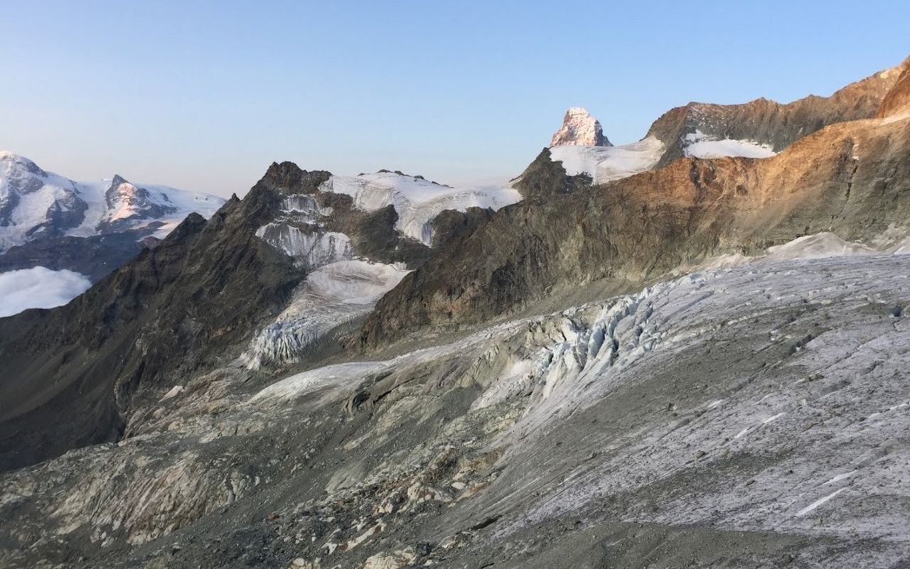
From the Rothornhütte (3197 m) start out right (E) of the Eseltschuggen (3360 m) and follow screes up onto the Rothorngletscher, which you cross in a northeast direction. The initially steep, later gentle slopes of this glacier end abruptly on the Unter Äschjoch (saddle) at 3551 m, 1 hour. From the saddle, climb over the firn and rocks of the SE ridge to gain the Ober Äschhorns (3668 m), ¼ hrs.
Oberes Aeschhorn - Hohlichtpass
From there you descend on the SW ridge over Firn and then rock to Ober Äschjoch (3621 m), or directly west down the firn flank on the the upper plateau of the Hohlichtgletschers. (If coming from the Ober Äschjoch there is a large bergschrund to overcome). Keep left (W) on the plateau to bypass a zone of wide crevasses (at about 3420 m). Then arc slowly round beneath the Zinalrothorn to the foot of the Col de Moming. Beneath the mighty seracs in this area move swiftly to the right (NE) at about 3500 m, then climb up and right (E) of the south-east rocks of Pointe Nord de Moming. Continue north via gentle firn slopes until you reach the Hohlichtpass (3734 m), 1 ½ hours.
Hohlichtpass - Schalihorn
From the pass, climb up the steeper firn of the SSW-Ridge, and onto a final easy rock section to reach the south summit of Schalihorn (3974 m), ½ hrs.
Descents
Follow the route of ascent
Additional information
- Departure point
-
-
- Time
-
Der Durchgang über die Bergschründe erfordert oft zusätzlichen Zeitaufwand.
- Difficulty
-
Die Verhältnisse auf dem Rothorn- und Hohlichtgletscher wechseln schnell.
- Waypoints
-
-
- History
-
Thomas Middlemore with mountain guides Johannes Jaun und Christian Lauener, 20. July 1873.


