![[Translate to English:]](/fileadmin/Der_SAC/Unserer_Partner/CSS_cyan_rgb.svg)


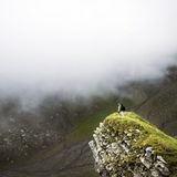
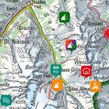
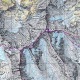
Schafwisspitz / Schofwisspitz 1989 m Mountain hiking
The summit has no name on the map. It is the highest point in the range west of Lauchwis. Schofwis, a pasture, is a regular slope leading up to the summit. The north and west sides are cliffs. The ridge, a watershed, leads to Stöllen (P. 1967).