Via the Mittelgrat (Normal route) Piz Sardona / Surenstock 3056 m
-
- Difficulty
- PD, 2a
-
- Ascent
- 2–3:30 h, 900 m
-
- Descent
- 1:30–2 h, 900 m
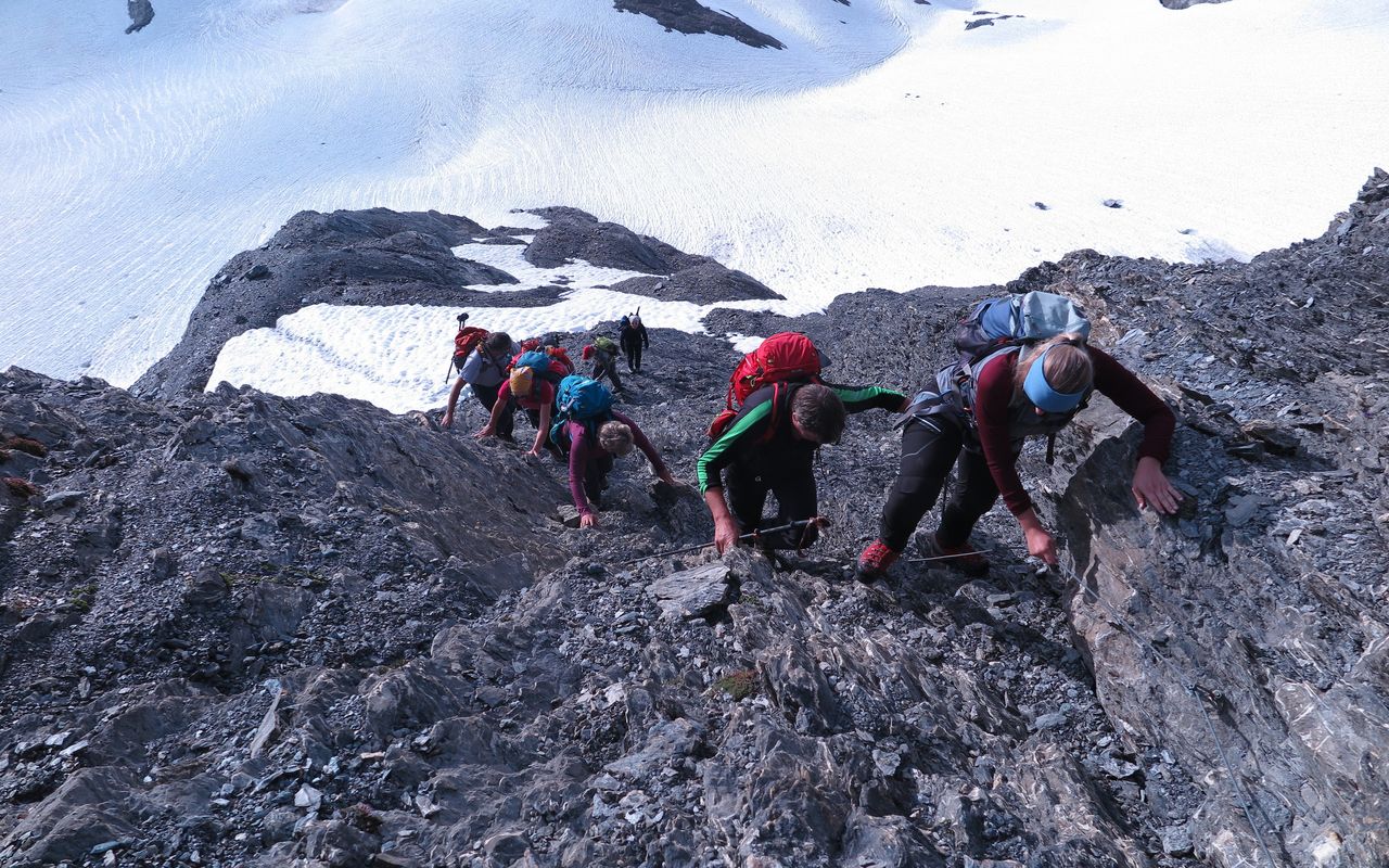
Normal route from the Sardonahütte, in summer certainly the most popular. The level of snowmelt determines the best route: When the firn snow on the upper, triangular glacier, thins out to reveal an ice slope, it is better to join the Mittelgrat as early as possible. The route through the rock is marked in the lower part with cairns and secured in the upper part with a fixed rope.



Route description
Sardonahütte - Sardonagletscher
From the Sardonahütte (2159 m) the path leads southwest across meadows to P. 2328 (turnoff to the Trinser Furgga). Take the steep right-hand path up to the Sardon glacier.
Sardonagletscher - Mittelgrat - Piz Sardona
When the triangular snowfield is well established, you may climb from the Sardonagletscher almost to its top, before moving left onto the rock near the striking yellow band. Traverse the scree-covered rock ramp leading to the "Mittelgrat", then follow this ridge on its northern side (II). After the flatter upper part of the ridge you reach an barren terrace. Pass through a shallow depression and climb northwards on well-established tracks to the summit.
Alpine hike to Piz Segnas
Alternative/ additional summits: From the summit of Piz Sardona you can reverse past the Mittelgrat on good tracks to the Surenjoch (P. 2943) and on to the beautiful humpback of the fore-summit (P. 3038). Traverse another scree ridge to gain the slightly higher summit of Piz Segnas, about 1 ½ hours back and forth.
Descent
Down the route of ascent.
Additional information
- Departure and arrival point
-
-
- Difficulty
-
The route can pass as a tough T6 hiking route.
- Waypoints
-
Auf der Variante zum Piz Segnas.
-
-
Alternative destination.
-


