
![[Translate to English:]](/fileadmin/Der_SAC/Unserer_Partner/CSS_cyan_rgb.svg)


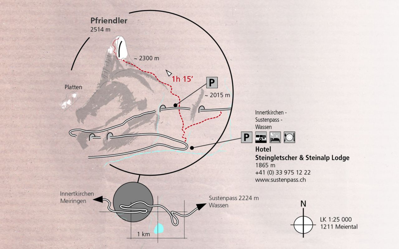
Approach to the Pfriendler Pfriendler 2514 m
-
- Difficulty
- T3
-
- Ascent
- 0:45–1:15 h, 550 m

Route description
Steingletscher - cliff base
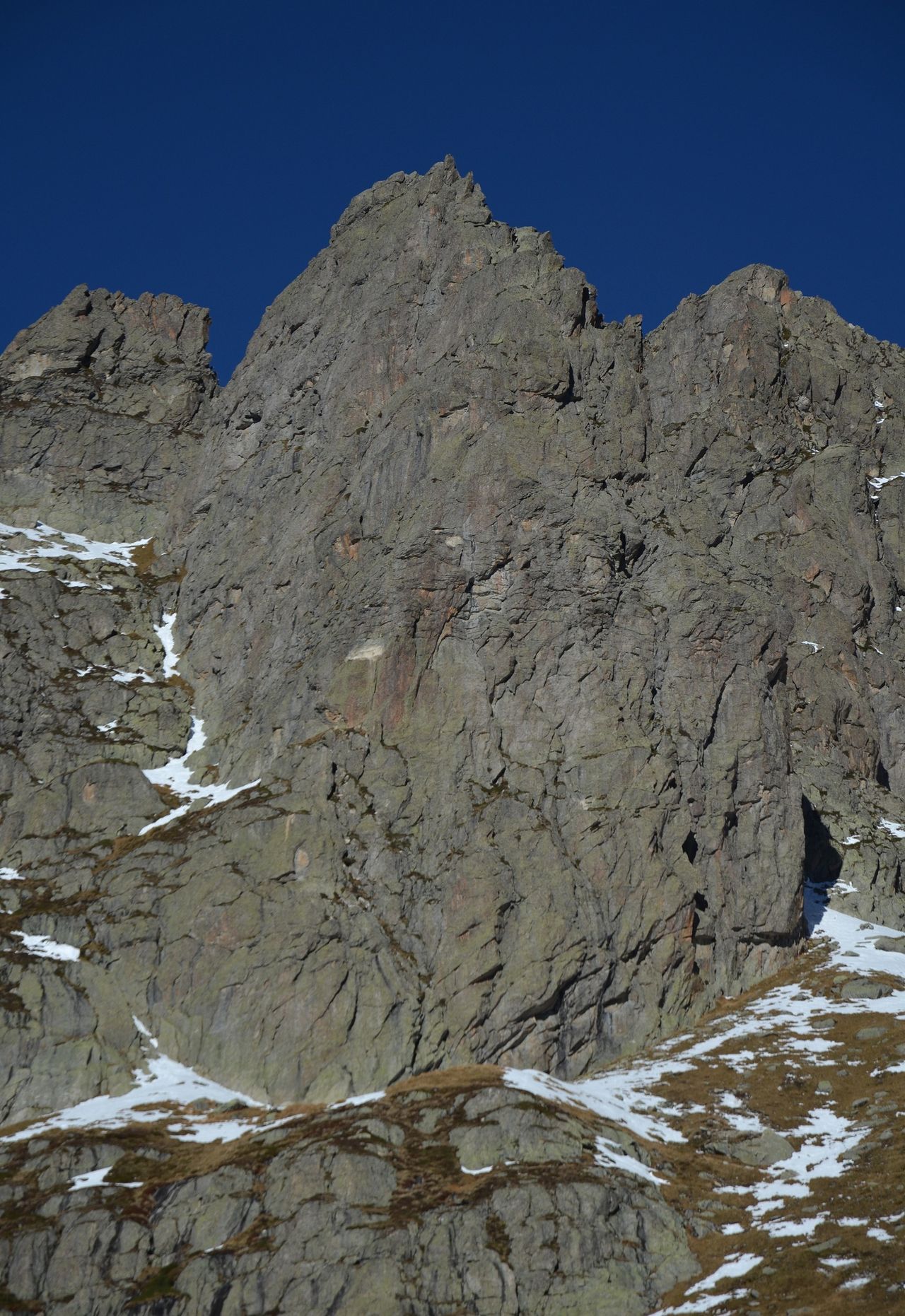
From the Steingletscher, follow the hiking trail north. At the fork, turn left (W), then northwards and cross the pass road. Follow the at-first-well-marked trail, then get lost while cross the talus slope, before finding it again higher up and crossing over the base of the route at circa 2340 m.
Additional information
- Departure and arrival point
-
-
- Time
-
Approach from Steingletscher (public transport) or from the parking at the 25km marker stone on the Sustenpass road.
- Difficulty / Material
-
Not difficult. Though the passage over the scree/talus field requires sure-footedness.


