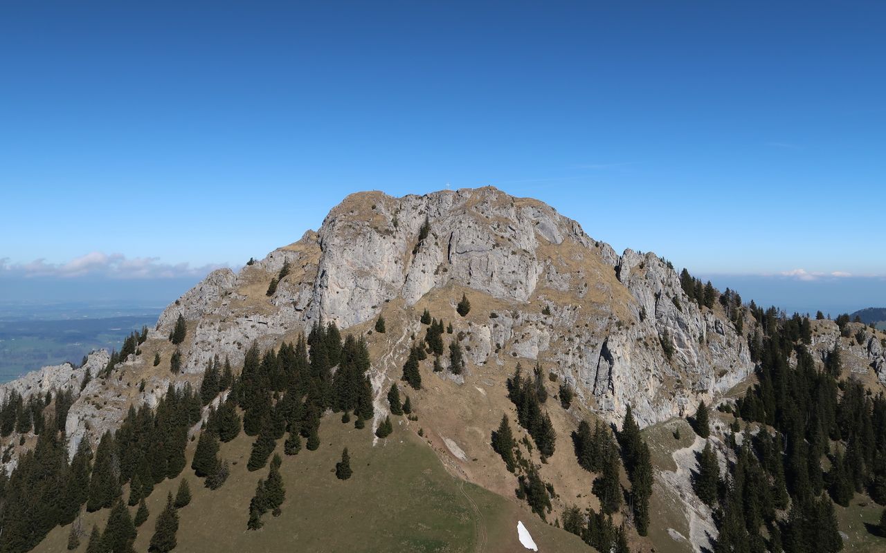
Broc – Dent de Broc – Gruyères (Normal route) Dent de Broc 1828 m
-
- Difficulty
- T4
-
- Ascent
- 4 h, 1240 m
-
- Descent
- 2:30 h, 1200 m
The landmark mountain of Broc and Gruyère is tasty
Granted, if you want to get from Broc (chocolate factory) to Gruyères (picturesque medieval town) it is not necessary to climb Dent de Broc, but definitely more interesting.


Route description
Broc – bifurcation to Dent de Broc (ca. 1740 m)
From the Broc railway station follow the road towards Charmey until you can branch off right at P. 727 just after the Le Home bus stop. Follow the hiking trail via Les Plains and Grosses Ciernes in pastures and forests to ascend the increasingly steep N face of Dent de Broc to the col at P. 1634 in the W ridge. Descend a few steps on the south side and then hike along the rock wall until you meet the trail coming from Col de Combes.
Bifurcation to Dent de Broc (ca. 1740 m) – Dent de Broc – Col de Combes
Now ascend eastward on an exposed ledge until on the left-hand side you can scramble up a grassy and rocky dihedral to reach the E ridge. On the exposed ridge ascend to the highest point (1828 m) and the summit cross (with summit book). You can go a few steps further on the summit ridge to take a glimpse of the view deep down to Gruyères. Go back to the summit and descend to Col des Combes on the ascent route.
Col des Combes – Gruyères
There is a path in the valley between the west ridges of Dent de Broc and Dent du Chamois, initially in pastures, then through the forest. From Le Châtelet go northward to Pont qui Branle (699 m) across the Saane. Follow the narrow road up to the main road. Cross the road and ascend the stairs. You reach the church and the cemetery and enter the town. On the right-hand side is the castle on top of a hill (830 m). Descend a path to a chapel, pass the parking lot on the left-hand side and go towards Institut de la Gruyère and finally to the railway station.
Variant: through Gorges de la Jogne to Col des Combes
The popular trail through the Gorges de la Jogne is slightly longer than the direct ascent on the N face. Above the retaining wall follow the trail along the shore of Lac de Montsalvens to enter the Vallée du Motélon. A steep gully (T3), which can be bypassed on a detour, is a shortcut to Les Cerniettes. Before crossing a creek ascend pathless to La Quartenouda and then ascend to Col des Combes cutting short as many bends of the road as the conditions of the pastures allow; T1-T2, ca. 3½ h.
Additional information
- Time
-
Total hiking time: 6¼ h
Broc – Les Plains – Dent de Broc: 3½ h
Dent de Broc – Le Châtelet – Gruyères: 2¾ h
- Difficulty / Material
-
The exposed summit ridge is T4, the rest T2. The trails are only partially marked. The last stretch requires surefootedness and being comfortable with heights.
- Waypoints
-
-


